Providence Chapel and Mill Lane Cottages
Introduction
The photograph on this page of Providence Chapel and Mill Lane Cottages by Ian Capper as part of the Geograph project.
The Geograph project started in 2005 with the aim of publishing, organising and preserving representative images for every square kilometre of Great Britain, Ireland and the Isle of Man.

There are currently over 7.5m images from over 14,400 individuals and you can help contribute to the project by visiting https://www.geograph.org.uk
Providence Chapel and Mill Lane Cottages
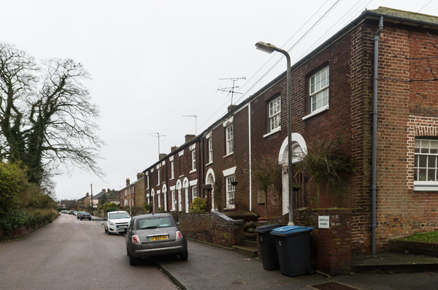
Image: © Ian Capper Taken: 25 Jan 2014
Late 18th century terrace, with end building added in 1822 as a Wesleyan chapel - a plaque on the wall states "Providence Chapel 1822". Grade II listed - see www.historicengland.org.uk/listing/the-list/list-entry/1363275.
Images are licensed for reuse under creativecommons.org/licenses/by-sa/2.0
Image Location
Latitude
51.244484
Longitude
1.305769