The diverted Knock River, Orangefield Park, Belfast (2)
Introduction
The photograph on this page of The diverted Knock River, Orangefield Park, Belfast (2) by Albert Bridge as part of the Geograph project.
The Geograph project started in 2005 with the aim of publishing, organising and preserving representative images for every square kilometre of Great Britain, Ireland and the Isle of Man.

There are currently over 7.5m images from over 14,400 individuals and you can help contribute to the project by visiting https://www.geograph.org.uk
The diverted Knock River, Orangefield Park, Belfast (2)
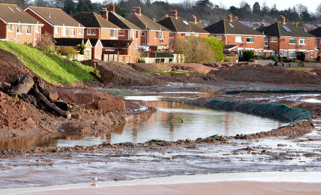
Image: © Albert Bridge Taken: 1 Feb 2014
The Knock River, looking upstream, on its new course through Orangefield Park. Although successfully diverted there is still quite a bit of work remaining. This view Image in December 2011 shows the same (approximate) area long before work started on the scheme.
Images are licensed for reuse under creativecommons.org/licenses/by-sa/2.0
Image Location
Latitude
54.588329
Longitude
-5.877772