Forbes Place
Introduction
The photograph on this page of Forbes Place by Thomas Nugent as part of the Geograph project.
The Geograph project started in 2005 with the aim of publishing, organising and preserving representative images for every square kilometre of Great Britain, Ireland and the Isle of Man.

There are currently over 7.5m images from over 14,400 individuals and you can help contribute to the project by visiting https://www.geograph.org.uk
Forbes Place
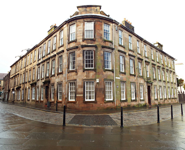
Image: © Thomas Nugent Taken: 27 Jan 2014
The elegantly curved corner of the building at the south east of Forbes Place, overlooking White Cart Water, with views of the abbey. A Category B Listed building http://data.historic-scotland.gov.uk/pls/htmldb/f?p=2200:15:0::::BUILDING:38974 .
Images are licensed for reuse under creativecommons.org/licenses/by-sa/2.0
Image Location
Latitude
55.844066
Longitude
-4.422289