Christ Church Vicarage, Great Lumley
Introduction
The photograph on this page of Christ Church Vicarage, Great Lumley by Robert Graham as part of the Geograph project.
The Geograph project started in 2005 with the aim of publishing, organising and preserving representative images for every square kilometre of Great Britain, Ireland and the Isle of Man.

There are currently over 7.5m images from over 14,400 individuals and you can help contribute to the project by visiting https://www.geograph.org.uk
Christ Church Vicarage, Great Lumley
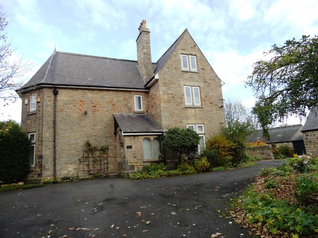
Image: © Robert Graham Taken: 13 Nov 2013
Although Great Lumley dates back to medieval times, it didn't have a parish church until 1859. The vicarage here is called Red House on the 1862 1:10,560 first series Ordnance Survey map, and so was probably bought after this date for the vicarage. It looks quite old, early 19th century perhaps.
Images are licensed for reuse under creativecommons.org/licenses/by-sa/2.0
Image Location
Latitude
54.837452
Longitude
-1.535222