171 at Slaght
Introduction
The photograph on this page of 171 at Slaght by The Carlisle Kid as part of the Geograph project.
The Geograph project started in 2005 with the aim of publishing, organising and preserving representative images for every square kilometre of Great Britain, Ireland and the Isle of Man.

There are currently over 7.5m images from over 14,400 individuals and you can help contribute to the project by visiting https://www.geograph.org.uk
171 at Slaght
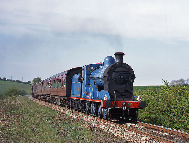
Image: © The Carlisle Kid Taken: 13 May 2001
Former GNR(I) 4.4.0 No. 171 "Slieve Gullion" brings the RPSI "Belfast & Northern Counties" railtour towards Slaght crossing, south of Ballymena.
Images are licensed for reuse under creativecommons.org/licenses/by-sa/2.0
Image Location
Latitude
54.83194
Longitude
-6.295502