Cullingworth Viaduct
Introduction
The photograph on this page of Cullingworth Viaduct by David Spencer as part of the Geograph project.
The Geograph project started in 2005 with the aim of publishing, organising and preserving representative images for every square kilometre of Great Britain, Ireland and the Isle of Man.

There are currently over 7.5m images from over 14,400 individuals and you can help contribute to the project by visiting https://www.geograph.org.uk
Cullingworth Viaduct
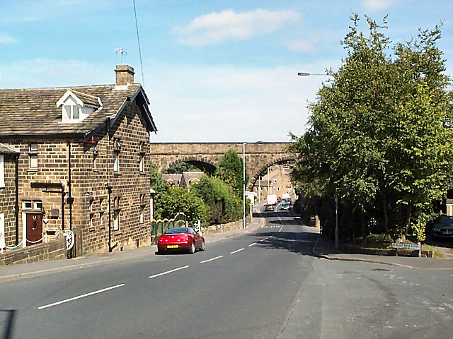
Image: © David Spencer Taken: 15 Aug 2005
At the southern end of the village, the long disused Great Northern viaduct crosses Haworth Road (the B6144 towards Bradford). The junction of the B6144 and the B6429 can be seen beyond. Cullingworth was on the Queensbury to Keighley line. The route has recently been opened to cyclists and pedestrians as part of the National Cycle Network.
Images are licensed for reuse under creativecommons.org/licenses/by-sa/2.0
Image Location


Leaflet Map data © OpenStreetMap
Latitude
53.822931
Longitude
-1.900919