Widmerpool Village Sign
Introduction
The photograph on this page of Widmerpool Village Sign by Alan Murray-Rust as part of the Geograph project.
The Geograph project started in 2005 with the aim of publishing, organising and preserving representative images for every square kilometre of Great Britain, Ireland and the Isle of Man.

There are currently over 7.5m images from over 14,400 individuals and you can help contribute to the project by visiting https://www.geograph.org.uk
Widmerpool Village Sign
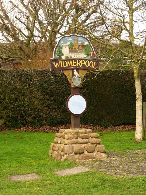
Image: © Alan Murray-Rust Taken: 24 Jan 2014
Erected in 2000 as a millennium celebration. The round plaque is shown here http://www.geograph.org.uk/photo/3828022 and details of the sign can be found on the brass plate below it http://www.geograph.org.uk/photo/3828023 . The main panel depicts the church, Widmerpool Hall, Fairham Brook and the telephone kiosk, which was apparently the earliest rural kiosk in England.
Images are licensed for reuse under creativecommons.org/licenses/by-sa/2.0
Image Location
Latitude
52.84589
Longitude
-1.062323