Tir na nOg
Introduction
The photograph on this page of Tir na nOg by Robin Webster as part of the Geograph project.
The Geograph project started in 2005 with the aim of publishing, organising and preserving representative images for every square kilometre of Great Britain, Ireland and the Isle of Man.

There are currently over 7.5m images from over 14,400 individuals and you can help contribute to the project by visiting https://www.geograph.org.uk
Tir na nOg
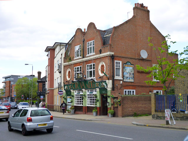
Image: © Robin Webster Taken: 12 May 2012
Formerly the Horse and Groom, which name is still inscribed in the roundel above the near door. The other roundel gives the date, 1904, and a monogram presumably representing the brewer, involving what looks like T H B and possibly another B (in some order or other). Trueman, Hanbury, Buxton springs to mind. There was a pub of this name at this site before 1904.
Images are licensed for reuse under creativecommons.org/licenses/by-sa/2.0
Image Location
Latitude
51.452548
Longitude
-0.191053