Ballintoy parish church
Introduction
The photograph on this page of Ballintoy parish church by Albert Bridge as part of the Geograph project.
The Geograph project started in 2005 with the aim of publishing, organising and preserving representative images for every square kilometre of Great Britain, Ireland and the Isle of Man.

There are currently over 7.5m images from over 14,400 individuals and you can help contribute to the project by visiting https://www.geograph.org.uk
Ballintoy parish church
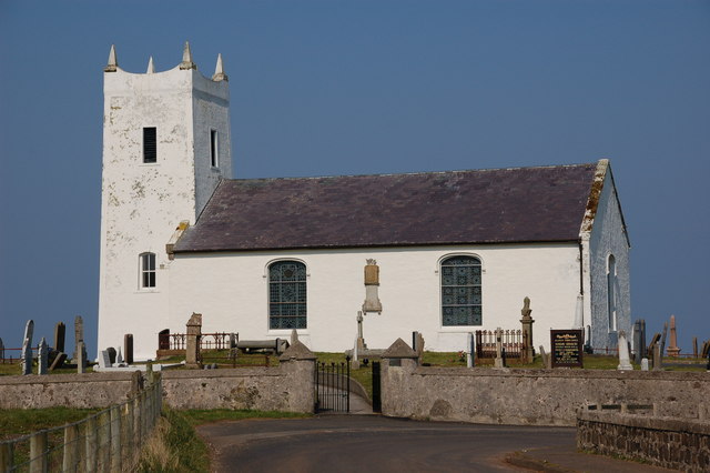
Image: © Albert Bridge Taken: 31 Mar 2007
Ballintoy (CoI) parish church sits beside a sharp bend on a minor road off the Bushmills-Ballycastle road. The first stone was laid on 10 April 1812 with the building completed on 15 December 1813. There is doubt about whether the tower was built at the same time or whether it comes from an earlier church.
Images are licensed for reuse under creativecommons.org/licenses/by-sa/2.0
Image Location
Latitude
55.236652
Longitude
-6.37381