Llys Seiriol 2
Introduction
The photograph on this page of Llys Seiriol 2 by Jonathan Wilkins as part of the Geograph project.
The Geograph project started in 2005 with the aim of publishing, organising and preserving representative images for every square kilometre of Great Britain, Ireland and the Isle of Man.

There are currently over 7.5m images from over 14,400 individuals and you can help contribute to the project by visiting https://www.geograph.org.uk
Llys Seiriol 2
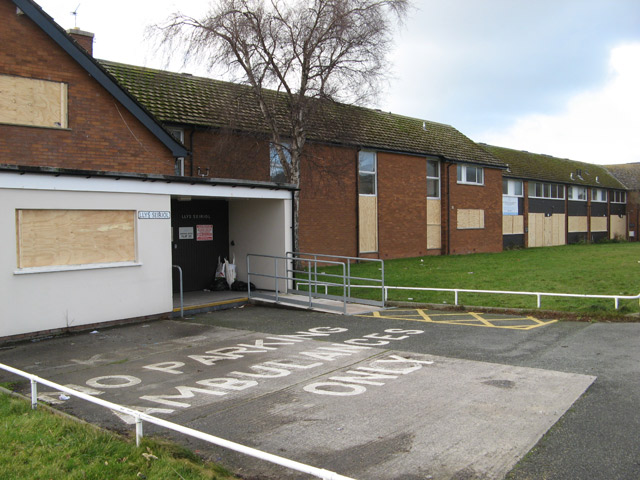
Image: © Jonathan Wilkins Taken: 23 Jan 2014
A sheltered housing complex, built in the late 1960s but now no longer deemed fit for purpose, is boarded up prior to demolition and re-development. Work is expected to start in the late Winter for completion in 2015. This view is from the communal entrance on St.Andrews Road.
Images are licensed for reuse under creativecommons.org/licenses/by-sa/2.0
Image Location
Latitude
53.318185
Longitude
-3.834992