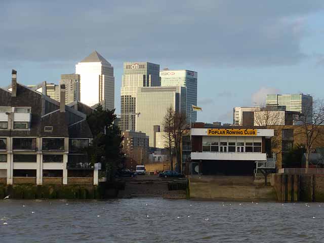
Poplar Rowing Club
Introduction
The photograph on this page of Poplar Rowing Club by Oliver Dixon as part of the Geograph project.
The Geograph project started in 2005 with the aim of publishing, organising and preserving representative images for every square kilometre of Great Britain, Ireland and the Isle of Man.
There are currently over 7.5m images from over 14,400 individuals and you can help contribute to the project by visiting https://www.geograph.org.uk

Image: © Oliver Dixon Taken: 23 Jan 2014
On the north bank of the Thames on the Isle of Dogs. Beyond are the skyscrapers of the Canary Wharf development Image From left to right is 1 Canada Square (frequently but erroneously referred to simply as "Canary Wharf"), 25 Canada Square (part of the Citigroup Centre) and the HSBC Tower (8 Canada Square, part hidden). When it was built in 1991, Canary Wharf at 235 metres high was the tallest building in the United Kingdom and stayed that way until the construction of the Shard twenty years later. Numbers 25 and 8 Canada Square completed at the beginning of the present century are both 200 metres high, making them joint fourth tallest building in the United Kingdom.
Image Location


