Moorbridge Pond Nature Reserve, Bestwood, Notts.
Introduction
The photograph on this page of Moorbridge Pond Nature Reserve, Bestwood, Notts. by David Hallam-Jones as part of the Geograph project.
The Geograph project started in 2005 with the aim of publishing, organising and preserving representative images for every square kilometre of Great Britain, Ireland and the Isle of Man.

There are currently over 7.5m images from over 14,400 individuals and you can help contribute to the project by visiting https://www.geograph.org.uk
Moorbridge Pond Nature Reserve, Bestwood, Notts.
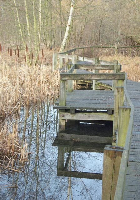
Image: © David Hallam-Jones Taken: 24 Jan 2014
An observation platform and passing point on the raised boardwalk. Moorbridge Pond and the nearby Springfield Corner Reserve site - on the other side of the Hucknall-Nottingham tram route - were awarded Local Nature Reserve (LNR) status, as a joint site, in June 2012.
Images are licensed for reuse under creativecommons.org/licenses/by-sa/2.0
Image Location
Latitude
53.013199
Longitude
-1.186142