
WW2 Pillbox by the River Dee
Introduction
The photograph on this page of WW2 Pillbox by the River Dee by John S Turner as part of the Geograph project.
The Geograph project started in 2005 with the aim of publishing, organising and preserving representative images for every square kilometre of Great Britain, Ireland and the Isle of Man.

There are currently over 7.5m images from over 14,400 individuals and you can help contribute to the project by visiting https://www.geograph.org.uk
WW2 Pillbox by the River Dee
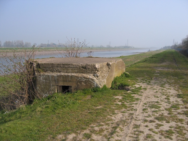
Image: © John S Turner Taken: 27 Mar 2007
Looking along the River Dee towards Saltney and Chester we can see this World War Two pillbox half buried after work has been done to build up the embankment. At least one other pillbox along the Dee has been removed, but this one remains. It is not recorded on any map I have seen, but by carefully comparing the Windows Live Local aerial photograph with Magic Map, I estimate it is just a few metres inside the square SJ3367. There is another pillbox nearer to Chester, which isn't buried and is in better condition - see Image .
Images are licensed for reuse under creativecommons.org/licenses/by-sa/2.0
Image Location

Latitude
53.204763
Longitude
-3.001705