The Almshouse, Leinthall Earls
Introduction
The photograph on this page of The Almshouse, Leinthall Earls by Philip Pankhurst as part of the Geograph project.
The Geograph project started in 2005 with the aim of publishing, organising and preserving representative images for every square kilometre of Great Britain, Ireland and the Isle of Man.

There are currently over 7.5m images from over 14,400 individuals and you can help contribute to the project by visiting https://www.geograph.org.uk
The Almshouse, Leinthall Earls
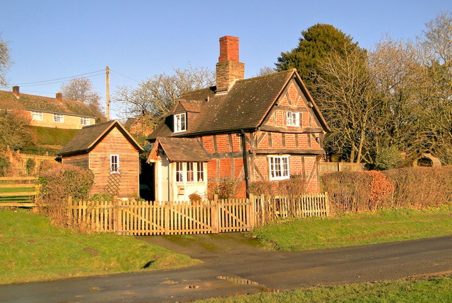
Image: © Philip Pankhurst Taken: 11 Jan 2014
In the centre of this charming small hamlet at the gate to Gatley Park and bathed in early winter sunshine, this 17th century cottage was formerly the village almshouse.
Images are licensed for reuse under creativecommons.org/licenses/by-sa/2.0
Image Location


Leaflet Map data © OpenStreetMap
Latitude
52.304942
Longitude
-2.817883