Lillands Farm, Rastrick
Introduction
The photograph on this page of Lillands Farm, Rastrick by Humphrey Bolton as part of the Geograph project.
The Geograph project started in 2005 with the aim of publishing, organising and preserving representative images for every square kilometre of Great Britain, Ireland and the Isle of Man.

There are currently over 7.5m images from over 14,400 individuals and you can help contribute to the project by visiting https://www.geograph.org.uk
Lillands Farm, Rastrick
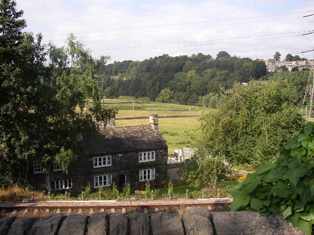
Image: © Humphrey Bolton Taken: Unknown
Lillands Farm dates back to medieval times, and the present building is dated 1741 according to the listing detail (it is listed, Grade II). It is safely elevated above flood level and looks out over its fields within a meander of the River Calder. The Lancashire and Yorkshire Railway of 1840 is in the foreground, separating the house from the 19C and 20C development of Rastrick.
Images are licensed for reuse under creativecommons.org/licenses/by-sa/2.0
Image Location


Leaflet Map data © OpenStreetMap
Latitude
53.700104
Longitude
-1.791243