Salisbury Street
Introduction
The photograph on this page of Salisbury Street by Christopher Hall as part of the Geograph project.
The Geograph project started in 2005 with the aim of publishing, organising and preserving representative images for every square kilometre of Great Britain, Ireland and the Isle of Man.

There are currently over 7.5m images from over 14,400 individuals and you can help contribute to the project by visiting https://www.geograph.org.uk
Salisbury Street
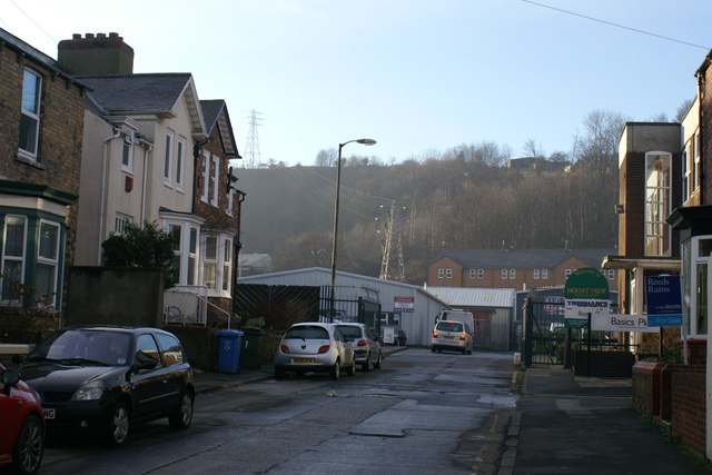
Image: © Christopher Hall Taken: 20 Jan 2014
Another Street running off from Seamer Road. This street contains a mixture of residential uses.The area beyond the steel fence and gates is the site of Scarborough's first power station.Scarborough Corporation obtained powers in 1891 to supply electricity but in 1894 transferred those powers to the Scarborough Electric Supply Company. Construction of the power station commenced in February 1893 and supply of electricity started in August of that year. From 1904 the Scarborough Tramways Company was supplied. In 1925 Scarborough Corporation re-acquired the undertaking and on 1st April 1948 it was taken over by the British Electricity Authority when electricity undertakings were nationalised. Power now comes in from the national grid and there is nothing to see of the power station, the site is a small industrial estate.
Images are licensed for reuse under creativecommons.org/licenses/by-sa/2.0
Image Location
Latitude
54.271938
Longitude
-0.41691