The Avenue, Harewood
Introduction
The photograph on this page of The Avenue, Harewood by Derek Harper as part of the Geograph project.
The Geograph project started in 2005 with the aim of publishing, organising and preserving representative images for every square kilometre of Great Britain, Ireland and the Isle of Man.

There are currently over 7.5m images from over 14,400 individuals and you can help contribute to the project by visiting https://www.geograph.org.uk
The Avenue, Harewood
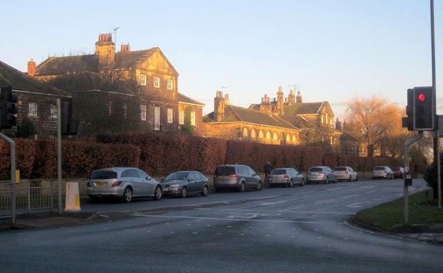
Image: © Derek Harper Taken: 26 Dec 2013
With the junction with the A61 in the foreground. The Avenue is the A659. The sunlit buildings are almost entirely in Image, so I nearly put the image in that square. The gable end left of centre belongs to what was formerly the house of the manager of the Harewood Estate http://list.english-heritage.org.uk/resultsingle.aspx?uid=1226651&searchtype=mapsearch . The lower building in the centre was formerly a "ribbon factory, now 4 cottages" http://list.english-heritage.org.uk/resultsingle.aspx?uid=1265739&searchtype=mapsearch . On the right is a "former doctor's surgery" http://list.english-heritage.org.uk/resultsingle.aspx?uid=1226843&searchtype=mapsearch . The buildings are all grade II* listed and form part of John Carr's original model village for Edwin Lascelles, 1st Lord Harewood, in the mid-C18.
Images are licensed for reuse under creativecommons.org/licenses/by-sa/2.0
Image Location
Latitude
53.899991
Longitude
-1.51068