Loose village sign
Introduction
The photograph on this page of Loose village sign by Marathon as part of the Geograph project.
The Geograph project started in 2005 with the aim of publishing, organising and preserving representative images for every square kilometre of Great Britain, Ireland and the Isle of Man.

There are currently over 7.5m images from over 14,400 individuals and you can help contribute to the project by visiting https://www.geograph.org.uk
Loose village sign
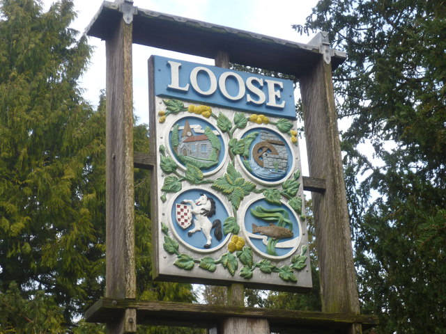
Image: © Marathon Taken: 18 Jan 2014
The name Loose seems to come from the Old English 'hlose' meaning 'place of pigs', probably reflecting the main activity of the local Saxon peasants. The Loose stream rises near Langley and flows into the river Medway near Tovil. For several hundred years until the early 20th century the valley was a local centre of industry with a number of ragstone quarries and a series of 13 water-powered mills. The historian William Lambarde recorded that the mills all existed in 1570. At various times they were engaged in fulling woollen cloth, paper making and corn grinding. They have all either been demolished or long ceased working but the Loose Valley and the sites of the mills were designated a Conservation Area by Maidstone Borough Council in 2000. The village sign in Church Street shows the Church of All Saints, a mill wheel and mill, the badge of Kent, and a fish representing the Loose stream. Loose was also famously the home of the Loose Women's Institute, a counterpart of the Ugley Working Men's Club in Essex.
Images are licensed for reuse under creativecommons.org/licenses/by-sa/2.0
Image Location
Latitude
51.240847
Longitude
0.515418