
Kington Camp ruins
Introduction
The photograph on this page of Kington Camp ruins by Peter Evans as part of the Geograph project.
The Geograph project started in 2005 with the aim of publishing, organising and preserving representative images for every square kilometre of Great Britain, Ireland and the Isle of Man.

There are currently over 7.5m images from over 14,400 individuals and you can help contribute to the project by visiting https://www.geograph.org.uk
Kington Camp ruins
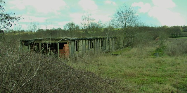
Image: © Peter Evans Taken: 19 Jan 2014
One of the derelict buildings remaining at Kington Camp on the Brilley Road, South-West of Kington. Built for use "by the British as a re-grouping point after Dunkirk, by the Americans as a major hospital installation, and after the war by the Polish Resettlement Corps". One of a number of these buildings that still remain on the site that has been used as a semi-industrial estate since WW2. See the excellent KINGTON CAMP website for more information. http://www.kingtoncamp.co.uk
Images are licensed for reuse under creativecommons.org/licenses/by-sa/2.0
Image Location

Latitude
52.183798
Longitude
-3.060214