Spondon village, Derbys.
Introduction
The photograph on this page of Spondon village, Derbys. by David Hallam-Jones as part of the Geograph project.
The Geograph project started in 2005 with the aim of publishing, organising and preserving representative images for every square kilometre of Great Britain, Ireland and the Isle of Man.

There are currently over 7.5m images from over 14,400 individuals and you can help contribute to the project by visiting https://www.geograph.org.uk
Spondon village, Derbys.
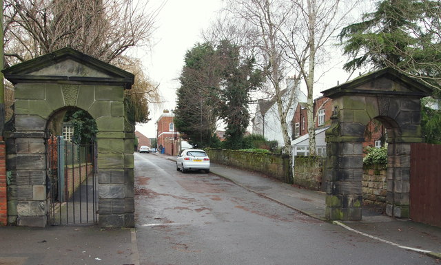
Image: © David Hallam-Jones Taken: 19 Jan 2014
An easterly view along Park Road towards Church Street. These stone gate piers mark the exit from the grounds of "Field House" (a former grand residence or Hall). The residence was built c.1750 for the Osborne family. Having fallen into disrepair c.1918 it was bought by the local Education Authority and is now the site of a school. The gates are all that remain of the property and they now serve to mark the entrance into the West Park School car park. They also serve as one of the access points into the West Park Meadows Local Nature Reserve.
Images are licensed for reuse under creativecommons.org/licenses/by-sa/2.0
Image Location
Latitude
52.920772
Longitude
-1.412168