Maidenhead Bridge, January 2014
Introduction
The photograph on this page of Maidenhead Bridge, January 2014 by Stefan Czapski as part of the Geograph project.
The Geograph project started in 2005 with the aim of publishing, organising and preserving representative images for every square kilometre of Great Britain, Ireland and the Isle of Man.

There are currently over 7.5m images from over 14,400 individuals and you can help contribute to the project by visiting https://www.geograph.org.uk
Maidenhead Bridge, January 2014
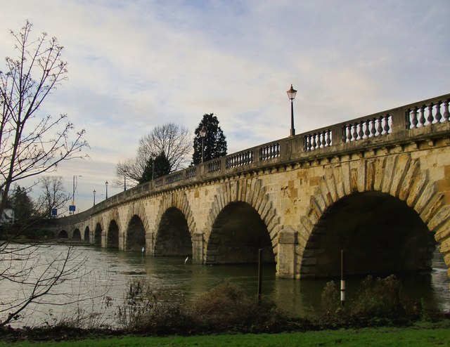
Image: © Stefan Czapski Taken: 14 Jan 2014
The bridge dates from the 1770's - something of a golden age for bridge-building along the middle Thames, producing fine stone-built structures at Chertsey and Richmond. The designer of Maidenhead Bridge was Robert Taylor, known as the architect of grand Thames-side houses such as Harleyford Manor (near Medmenham) and Asgill House, Richmond. The bridge was built to carry the Bath Road, later known as the Great West Road, currently the A4. The photo was taken during the very wet spell in January 2014, which resulted in widespread flooding in southern England. The water level was certainly higher than when Rod Allday was here on 27th August 2008 http://www.geograph.org.uk/photo/958691 but not much higher than it was three days earlier that month: http://www.geograph.org.uk/photo/948386
Images are licensed for reuse under creativecommons.org/licenses/by-sa/2.0
Image Location
Latitude
51.523803
Longitude
-0.703129