Cricket pavilion on The Butts
Introduction
The photograph on this page of Cricket pavilion on The Butts by Marathon as part of the Geograph project.
The Geograph project started in 2005 with the aim of publishing, organising and preserving representative images for every square kilometre of Great Britain, Ireland and the Isle of Man.

There are currently over 7.5m images from over 14,400 individuals and you can help contribute to the project by visiting https://www.geograph.org.uk
Cricket pavilion on The Butts
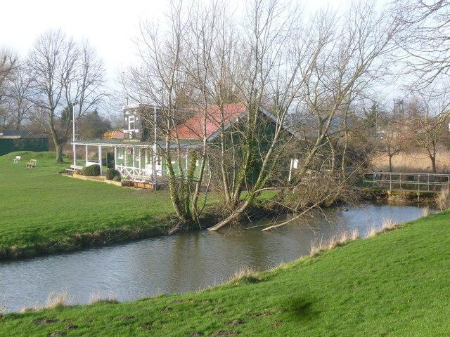
Image: © Marathon Taken: 12 Jan 2014
The Butts formed the western stretch of the old town defences for Sandwich, first built in 1384. It was used in medieval times as an archery practice field. Because of the town's history of violent raids, every man over 12 years of age would be expected to practice after attending church. It is believed that Henry V's archers practised here before sailing for France on their way to the Battle of Agincourt. The water here is the Delf Stream. This was greatly improved by Dutch water engineers in the later 15th century. They built many sluices so that all the fields could be irrigated. Their network of artificial streams formed the water supply and sewers for the whole of Sandwich until the late 19th century. The Butts is now used as a cricket pitch in the summer. The pavilion is seen across the water.
Images are licensed for reuse under creativecommons.org/licenses/by-sa/2.0
Image Location


Leaflet Map data © OpenStreetMap
Latitude
51.276484
Longitude
1.334757