Arnot Hill Park, Daybrook, Notts.
Introduction
The photograph on this page of Arnot Hill Park, Daybrook, Notts. by David Hallam-Jones as part of the Geograph project.
The Geograph project started in 2005 with the aim of publishing, organising and preserving representative images for every square kilometre of Great Britain, Ireland and the Isle of Man.

There are currently over 7.5m images from over 14,400 individuals and you can help contribute to the project by visiting https://www.geograph.org.uk
Arnot Hill Park, Daybrook, Notts.
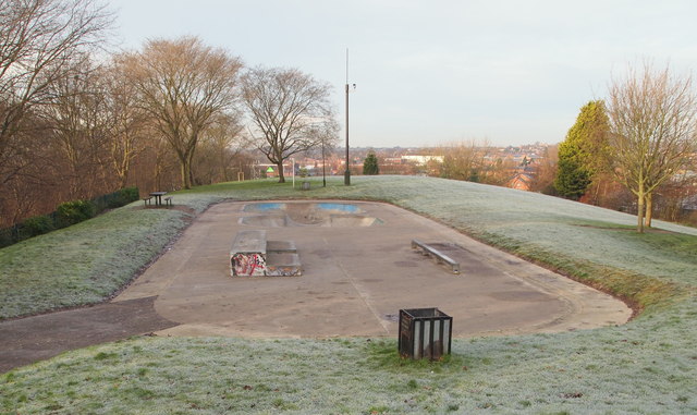
Image: © David Hallam-Jones Taken: 12 Jan 2014
Once inside this park's most easterly entrance/exit - reached from Arnot Hill Road - a curved, winding south-westerly path brings visitors to this plateau that now hosts several skateboarding hollows. On the left of this area, through a former railway cutting is the track-bed of the former Great Northern Railway Line's Derbyshire Extension hosting a footpath and cycle-route. The largest part of the park is to be found on the right, albeit at a lower level, and straight ahead - a mile away as the crow flies - Mansfield Road (i.e. the A60) is to be found.
Images are licensed for reuse under creativecommons.org/licenses/by-sa/2.0
Image Location
Latitude
52.995372
Longitude
-1.13135