Brick bridge over Bedale Beck
Introduction
The photograph on this page of Brick bridge over Bedale Beck by Matthew Hatton as part of the Geograph project.
The Geograph project started in 2005 with the aim of publishing, organising and preserving representative images for every square kilometre of Great Britain, Ireland and the Isle of Man.

There are currently over 7.5m images from over 14,400 individuals and you can help contribute to the project by visiting https://www.geograph.org.uk
Brick bridge over Bedale Beck
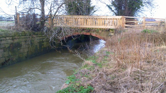
Image: © Matthew Hatton Taken: 10 Jan 2014
This part of Bedale Beck is known as Main Cut, this was down to it being part of the proposed Bedale Navigation. A grand scheme to link Bedale with the Swale, Ure & Ouse in the late 18thC, the work began at Bedale building a stone lined dock and the beck was straighten, here there was a lock built, the large stone wall is part of it, there are slots for the lock gates hidden under the ivy. However the scheme went bust, the gates were never built and the local mill owner built this brick bridge over the beck to link to Bedale market. The timber pailling is part of the Sustrans improvements to the bridleway.
Images are licensed for reuse under creativecommons.org/licenses/by-sa/2.0
Image Location
Latitude
54.29815
Longitude
-1.559598