Milestone, Penparcau Road
Introduction
The photograph on this page of Milestone, Penparcau Road by Ian Capper as part of the Geograph project.
The Geograph project started in 2005 with the aim of publishing, organising and preserving representative images for every square kilometre of Great Britain, Ireland and the Isle of Man.

There are currently over 7.5m images from over 14,400 individuals and you can help contribute to the project by visiting https://www.geograph.org.uk
Milestone, Penparcau Road
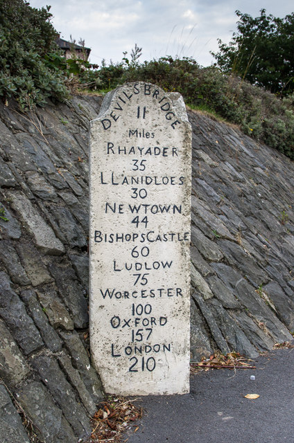
Image: © Ian Capper Taken: 23 Aug 2013
Close up of the milestone in Image and Image, one of three similar stones situated a mile from Aberystwyth on each of the main roads into the town, all dating from the 19th century. This is the east face, looking towards the town - see Image for the west face. Grade II listed - see http://cadwpublic-api.azurewebsites.net/reports/listedbuilding/FullReport?lang=en&id=10419.
Images are licensed for reuse under creativecommons.org/licenses/by-sa/2.0
Image Location
Latitude
52.402181
Longitude
-4.074337