Long Lane crossing 2
Introduction
The photograph on this page of Long Lane crossing 2 by Christopher Hall as part of the Geograph project.
The Geograph project started in 2005 with the aim of publishing, organising and preserving representative images for every square kilometre of Great Britain, Ireland and the Isle of Man.

There are currently over 7.5m images from over 14,400 individuals and you can help contribute to the project by visiting https://www.geograph.org.uk
Long Lane crossing 2
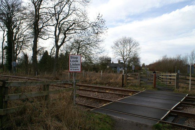
Image: © Christopher Hall Taken: 8 Jan 2014
Long Lane crossing was originally a road crossing but since the construction of the Seamer by-pass A64 which truncated the road, it has been reduced to a pedestrian crossing only. This photograph is taken from the east of the tracks. It is a double crossing; in the foreground the tracks of the Scarborough to Bridlington line, beyond that another, historically slightly earlier, crossing of the Scarborough to York line. The former crossing keeper's cottage shown in Image is in the background.
Images are licensed for reuse under creativecommons.org/licenses/by-sa/2.0
Image Location
Latitude
54.235532
Longitude
-0.42352