Spitalfields City Farm
Introduction
The photograph on this page of Spitalfields City Farm by Marathon as part of the Geograph project.
The Geograph project started in 2005 with the aim of publishing, organising and preserving representative images for every square kilometre of Great Britain, Ireland and the Isle of Man.

There are currently over 7.5m images from over 14,400 individuals and you can help contribute to the project by visiting https://www.geograph.org.uk
Spitalfields City Farm
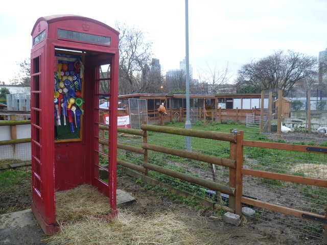
Image: © Marathon Taken: 8 Jan 2014
In 1979, local people turned an area of derelict ex railway land at the eastern end of Weaver Street in Spitalfields into allotments. As time went by, the land was also used to keep poultry and ducks. The number and variety of animals grew, as did the range of activities carried out on the site. This eventually became Spitalfields City Farm. Since then the farm lost some land along its northern side when the East London Line, which was previously in a tunnel, was upgraded to become part of London Overground and was put in a cutting through part of the farm's land. As compensation the farm took some land from Allen Gardens (a rather nondescript park) to the west. As well as a variety of animals including sheep, pigs, goats, cattle and ferrets the farm runs a variety of activities including a Young Farmers Club and Community Food Growing. See http://www.spitalfieldscityfarm.org/ for more information about the farm. The entrance is in Buxton Street. This photograph shows an old red telephone box adorned with a number of awards won at the Essex Young Farmers’ Country Show.
Images are licensed for reuse under creativecommons.org/licenses/by-sa/2.0
Image Location
Latitude
51.522141
Longitude
-0.066491