Sutton Road, Kingston upon Hull
Introduction
The photograph on this page of Sutton Road, Kingston upon Hull by Bernard Sharp as part of the Geograph project.
The Geograph project started in 2005 with the aim of publishing, organising and preserving representative images for every square kilometre of Great Britain, Ireland and the Isle of Man.

There are currently over 7.5m images from over 14,400 individuals and you can help contribute to the project by visiting https://www.geograph.org.uk
Sutton Road, Kingston upon Hull
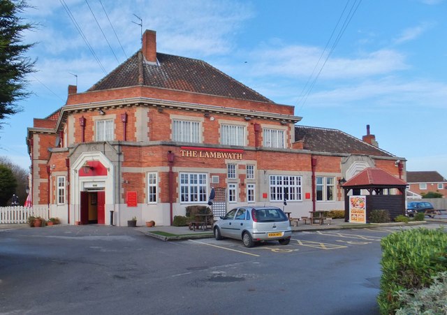
Image: © Bernard Sharp Taken: 6 Jan 2014
The Lambwath, Sutton Road, a large brewer's Neo-Georgian roadhouse, built 1938 for Moors' & Robson's Breweries Ltd. Incorporates M & R rainwater heads and incised initials above doorways. Interior incorporates some 17th century Jacobean oak panelling from the Old Hall, Anlaby. Licence transferred from Horns Tavern, Marlborough Terrace, February 1939, during a programme of slum clearance. See also: Image
Images are licensed for reuse under creativecommons.org/licenses/by-sa/2.0
Image Location
Latitude
53.774455
Longitude
-0.307916