Ings Farm and Bluestone Heath Road: aerial 2014
Introduction
The photograph on this page of Ings Farm and Bluestone Heath Road: aerial 2014 by Chris as part of the Geograph project.
The Geograph project started in 2005 with the aim of publishing, organising and preserving representative images for every square kilometre of Great Britain, Ireland and the Isle of Man.

There are currently over 7.5m images from over 14,400 individuals and you can help contribute to the project by visiting https://www.geograph.org.uk
Ings Farm and Bluestone Heath Road: aerial 2014
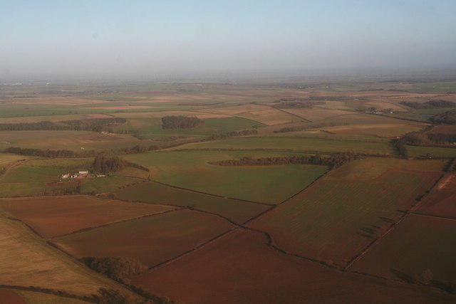
Image: © Chris Taken: 2 Jan 2014
From the SW. The Bluestone Heath Road runs across the centre. The bump on the right at the end of the line of trees is Rosin Hill, about 125m high. This can be seen more clearly in Image, which is another shot of this area, and of Rosin Hill, from the NW. The Bluestone Heath Road runs along the top of the Lincolnshire Wolds, thus affording some far-reaching views. To the East (top) the views are of the Marshes and Coastal Strip, and now also of enormous offshore windfarms. To the West (behind the camera) the Lincoln "Cliff" (and Cathedral) and the Trent Valley are visible from it.
Images are licensed for reuse under creativecommons.org/licenses/by-sa/2.0
Image Location
Latitude
53.275232
Longitude
-0.052333