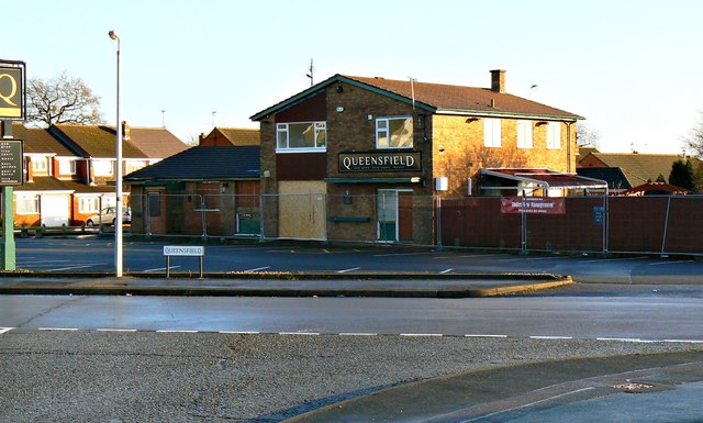
The Queensfield pub, Queensfield, Swindon
Introduction
The photograph on this page of The Queensfield pub, Queensfield, Swindon by Brian Robert Marshall as part of the Geograph project.
The Geograph project started in 2005 with the aim of publishing, organising and preserving representative images for every square kilometre of Great Britain, Ireland and the Isle of Man.
There are currently over 7.5m images from over 14,400 individuals and you can help contribute to the project by visiting https://www.geograph.org.uk

Image: © Brian Robert Marshall Taken: 2 Jan 2014
The pub is typical of its age, about 45 years old or thereabouts. Typically also, it is closed, empty and boarded up. It has had a chequered history in the last 4 years or so. It closed some time before 2009 then re-opened in March of that year http://www.swindonadvertiser.co.uk/news/4239602.Queensfield_pub_reopens_in_Swindon_with_Easter_raffle/ Then it closed again in September 2011 http://www.swindonadvertiser.co.uk/news/9257895.Last_orders_for_popular_publican/ It must have subsequently re-opened because in June 2013 it closed yet again http://www.swindonadvertiser.co.uk/news/10460241.Upper_Stratton_local_closes_yet_again/?ref=ar The last mention so far is December 2013 when it appears that the pub will be demolished to make way for new housing http://www.swindonadvertiser.co.uk/news/10903381.New_homes_may_be_built_on_site_of_pub/

