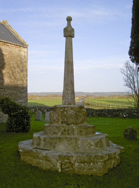
St Bridget's cross
Introduction
The photograph on this page of St Bridget's cross by Neil Owen as part of the Geograph project.
The Geograph project started in 2005 with the aim of publishing, organising and preserving representative images for every square kilometre of Great Britain, Ireland and the Isle of Man.
There are currently over 7.5m images from over 14,400 individuals and you can help contribute to the project by visiting https://www.geograph.org.uk

Image: © Neil Owen Taken: 31 Dec 2013
This little church has a cross in the grounds. The church itself was probably here in Saxon times as a modest wooden structure but after the coming of the Normans it was replaced by a stone one. It dates from the twelfth century and presumably the cross is no earlier. Certainly the church had a number of repairs and extensions in the following centuries but the cross looks like it has had a lot of modern concrete to keep it upright. See Image] for more of the church.

