St Bridget's tower
Introduction
The photograph on this page of St Bridget's tower by Neil Owen as part of the Geograph project.
The Geograph project started in 2005 with the aim of publishing, organising and preserving representative images for every square kilometre of Great Britain, Ireland and the Isle of Man.

There are currently over 7.5m images from over 14,400 individuals and you can help contribute to the project by visiting https://www.geograph.org.uk
St Bridget's tower
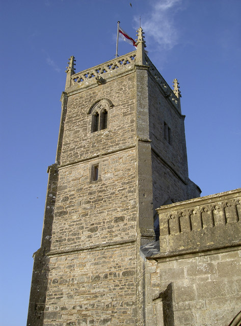
Image: © Neil Owen Taken: 31 Dec 2013
The little church in the north Somerset lowlands has been here since the twelfth century and is dedicated to the Irish saint Brigid of Kildare; it is English Heritage Grade I listed. See Image] for another view. The church was in a very poor state of upkeep by 2008, with a lot of damage by water ingress. However, a magnificent effort by local people and neighbouring parishes helped to more than meet the £100,000 needed for repairs. Events included pig-roasts, flamenco dancing, a Gilbert and Sullivan performance and an Irish themed occasion in honour of the patron saint. The tiny congregation of no more than twenty certainly made the village proud and celebrated the completion of the restoration on February 1st - St Bridget's Day.
Images are licensed for reuse under creativecommons.org/licenses/by-sa/2.0
Image Location
Latitude
51.411734
Longitude
-2.769057