The Blane Valley
Introduction
The photograph on this page of The Blane Valley by Thomas Nugent as part of the Geograph project.
The Geograph project started in 2005 with the aim of publishing, organising and preserving representative images for every square kilometre of Great Britain, Ireland and the Isle of Man.

There are currently over 7.5m images from over 14,400 individuals and you can help contribute to the project by visiting https://www.geograph.org.uk
The Blane Valley
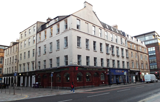
Image: © Thomas Nugent Taken: 26 Dec 2013
A pub at the corner of Glassford Street and Garth Street (on the left). A Category B Listed building http://data.historic-scotland.gov.uk/pls/htmldb/f?p=2200:15:0::::BUILDING:32684 .
Images are licensed for reuse under creativecommons.org/licenses/by-sa/2.0
Image Location
Latitude
55.859136
Longitude
-4.248722