The Shore Road, Greenisland - December 2013 (2)
Introduction
The photograph on this page of The Shore Road, Greenisland - December 2013 (2) by Albert Bridge as part of the Geograph project.
The Geograph project started in 2005 with the aim of publishing, organising and preserving representative images for every square kilometre of Great Britain, Ireland and the Isle of Man.

There are currently over 7.5m images from over 14,400 individuals and you can help contribute to the project by visiting https://www.geograph.org.uk
The Shore Road, Greenisland - December 2013 (2)
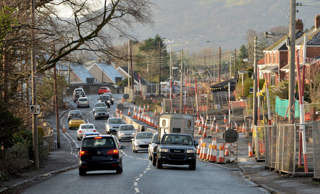
Image: © Albert Bridge Taken: 29 Dec 2013
The Shore Road, looking towards Jordanstown and Belfast. The new northbound carriageway is under construction on the right. I’ll guess that when complete it will be used by all traffic pending construction of the new southbound carriageway on the existing line (left).
Images are licensed for reuse under creativecommons.org/licenses/by-sa/2.0
Image Location
Latitude
54.691331
Longitude
-5.864332