St Herbert's Church, Currock
Introduction
The photograph on this page of St Herbert's Church, Currock by Rose and Trev Clough as part of the Geograph project.
The Geograph project started in 2005 with the aim of publishing, organising and preserving representative images for every square kilometre of Great Britain, Ireland and the Isle of Man.

There are currently over 7.5m images from over 14,400 individuals and you can help contribute to the project by visiting https://www.geograph.org.uk
St Herbert's Church, Currock
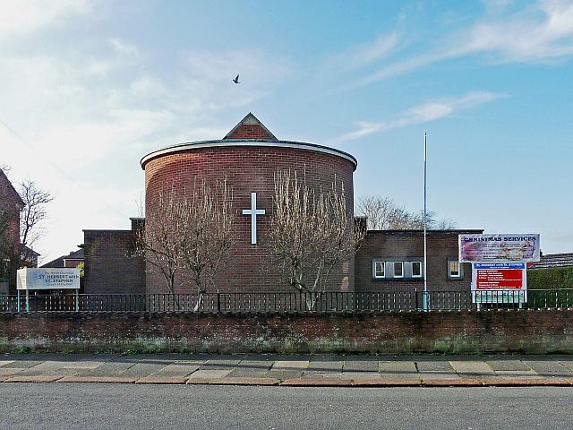
Image: © Rose and Trev Clough Taken: 25 Dec 2013
The Anglican parish church of St Herbert with St Stephen, Blackwell Road http://www.carlislediocese.org.uk/churches-and-clergy/parishes-and-clergy/carlisle/2300.html . St Herbert's was dedicated in 1932, and extended in 1969. The parish merged with that of St Stephen's Church in James Street, the latter was demolished in the 1960s (for location see Image ).
Images are licensed for reuse under creativecommons.org/licenses/by-sa/2.0
Image Location
Latitude
54.876817
Longitude
-2.932404