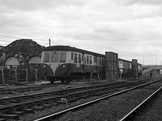
Queen's Quay station - station to Ballymacarrett Junction (6)
Introduction
The photograph on this page of Queen's Quay station - station to Ballymacarrett Junction (6) by The Carlisle Kid as part of the Geograph project.
The Geograph project started in 2005 with the aim of publishing, organising and preserving representative images for every square kilometre of Great Britain, Ireland and the Isle of Man.
There are currently over 7.5m images from over 14,400 individuals and you can help contribute to the project by visiting https://www.geograph.org.uk

Image: © The Carlisle Kid Taken: 10 Apr 1976
An MED set approaches Queen's Quay station - running through the carriage wash as that was the only line in use on the last day. At right background can be seen the footbridge to the Harland and Wolff shipyards with the Sydenham by-pass road bridge beyond. The derelict building at left was the former BCDR locomotive shed - unused since 1954 (at least). For "last day" views at Ballymacarrett Junction, go to: Image] and Image] . All locations are approximate as this site is now under the M3 motorway/cross-harbour link.

