The Coleraine ring road (1980)
Introduction
The photograph on this page of The Coleraine ring road (1980) by Albert Bridge as part of the Geograph project.
The Geograph project started in 2005 with the aim of publishing, organising and preserving representative images for every square kilometre of Great Britain, Ireland and the Isle of Man.

There are currently over 7.5m images from over 14,400 individuals and you can help contribute to the project by visiting https://www.geograph.org.uk
The Coleraine ring road (1980)
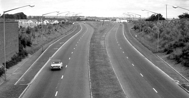
Image: © Albert Bridge Taken: 29 Jun 1980
See Image (June 2006). An earlier view, looking towards the Lodge Road roundabout (far distance) on a quiet Sunday morning. The widely-separated carriageways always looked a bit unusual. They might have been intended to accommodate a future flyover – something now suggested in the Northern Area Plan 2016 Coleraine Borough: Coleraine Transportation: “Lodge Road Roundabout, located where the A26 and A29 converge at the key junction on the network. The junction is anticipated to see a significant increase in the already high flows and, should this occur, will require a significant intervention towards the end of the Plan period to maintain efficient operation. Analysis has shown that grade separation of the traffic moving through the junction on the A29 axis would provide significant benefits in terms of improving capacity and maintaining turning provision”.
Images are licensed for reuse under creativecommons.org/licenses/by-sa/2.0
Image Location
Latitude
55.123411
Longitude
-6.665441