Reigate Town Hall
Introduction
The photograph on this page of Reigate Town Hall by Ian Capper as part of the Geograph project.
The Geograph project started in 2005 with the aim of publishing, organising and preserving representative images for every square kilometre of Great Britain, Ireland and the Isle of Man.

There are currently over 7.5m images from over 14,400 individuals and you can help contribute to the project by visiting https://www.geograph.org.uk
Reigate Town Hall
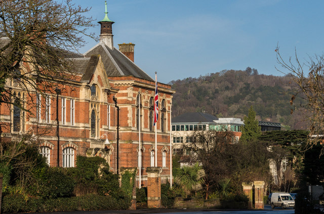
Image: © Ian Capper Taken: 14 Dec 2013
The offices of Reigate and Banstead Borough Council in Castlefield Road, dating from 1901. The building was designed by the architects Hugh Macintosh and Reginald Newman. The building is grade II listed - for listing particulars see www.historicengland.org.uk/listing/the-list/list-entry/1260489. In the background are the North Downs between Colley Hill and Reigate Hill.
Images are licensed for reuse under creativecommons.org/licenses/by-sa/2.0
Image Location
Latitude
51.23968
Longitude
-0.204931