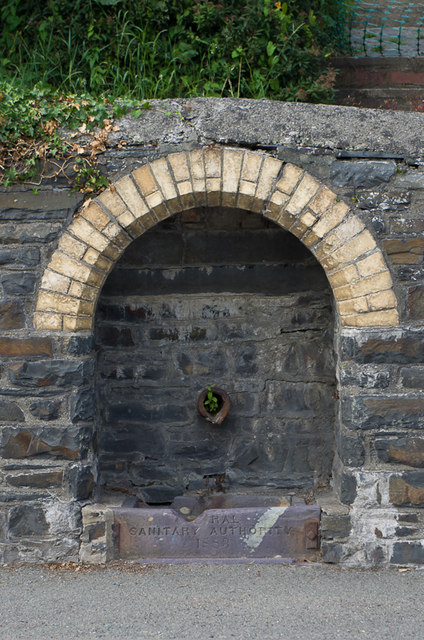
Water source, Llanbadarn Road
Introduction
The photograph on this page of Water source, Llanbadarn Road by Ian Capper as part of the Geograph project.
The Geograph project started in 2005 with the aim of publishing, organising and preserving representative images for every square kilometre of Great Britain, Ireland and the Isle of Man.
There are currently over 7.5m images from over 14,400 individuals and you can help contribute to the project by visiting https://www.geograph.org.uk

Image: © Ian Capper Taken: 3 Aug 2013
Close up of the water source shown in Image The 1889 map shows a W, or well, here, with later maps marking a "spout". The 1930s map shows a "mineral water works" on the opposite side of the road, now the site of the car park for Plascrug Leisure Centre. The 1849 "A topographical dictionary of Wales" mentions that "A chalybeate spring, which is in great estimation for the medicinal property of its waters, was discovered about the year 1779, at a short distance from the eastern extremity of the town, on the road to Llanbadarn-Vawr, and near Plâs Crûg: the well is covered with a small square building, from one side of which the water issues by a spout. There are various other springs in the neighbourhood having a ferruginous impregnation ..." Is this the same source? For a close up of the stone at the base of the spring, see Image

