Site of Merton Park station, 1998
Introduction
The photograph on this page of Site of Merton Park station, 1998 by Ben Brooksbank as part of the Geograph project.
The Geograph project started in 2005 with the aim of publishing, organising and preserving representative images for every square kilometre of Great Britain, Ireland and the Isle of Man.

There are currently over 7.5m images from over 14,400 individuals and you can help contribute to the project by visiting https://www.geograph.org.uk
Site of Merton Park station, 1998
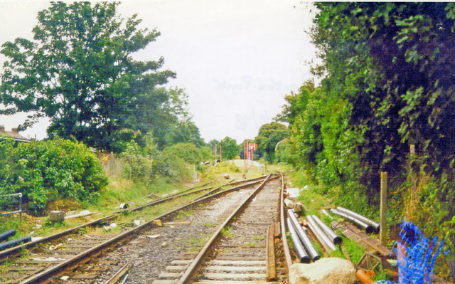
Image: © Ben Brooksbank Taken: 30 Aug 1998
View SE, towards West Croydon, also formerly (to the left) Merton Abbey and Tooting: ex-LB&SCR West Croydon - Wimbledon line and former ex-LB&SCR & LSWR Joint Merton Abbey loop. The station and the line to West Croydon had been closed 31/5/97 and was being converted to the Croydon Tramlink, with Merton Park tram-stop under construction in the distance. The Merton Abbey loop had been closed since 1/5/75 - see Image
Images are licensed for reuse under creativecommons.org/licenses/by-sa/2.0
Image Location
Latitude
51.413682
Longitude
-0.201503