Croydon Tramlink: Kingston Road level-crossing and Merton Park tram-stop, 2000
Introduction
The photograph on this page of Croydon Tramlink: Kingston Road level-crossing and Merton Park tram-stop, 2000 by Ben Brooksbank as part of the Geograph project.
The Geograph project started in 2005 with the aim of publishing, organising and preserving representative images for every square kilometre of Great Britain, Ireland and the Isle of Man.

There are currently over 7.5m images from over 14,400 individuals and you can help contribute to the project by visiting https://www.geograph.org.uk
Croydon Tramlink: Kingston Road level-crossing and Merton Park tram-stop, 2000
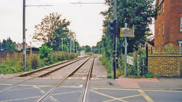
Image: © Ben Brooksbank Taken: 22 Sep 2000
View SE from A238 towards Mitcham and Croydon etc., formerly West Croydon SR/LB&SCR. The original ex-LB&SCR Wimbledon - West Croydon line (electrified by the SR in 1930) was closed 31/5/97 for conversion to the Tramlink, which opened 30/5/00. The original Merton Park station had been nearer this crossing and had an extra platform on the ex-LSWR & LB&SCR Joint line to Tooting, the Merton Abbey chord. The Loop lost its passenger service from 2/3/29, but freight continued for many years, from the Merton Park end after severance of the line at Tooting Junction on 10/3/34, until 1/5/75.
Images are licensed for reuse under creativecommons.org/licenses/by-sa/2.0
Image Location
Latitude
51.413405
Longitude
-0.201083