Allesley Old Road
Introduction
The photograph on this page of Allesley Old Road by E Gammie as part of the Geograph project.
The Geograph project started in 2005 with the aim of publishing, organising and preserving representative images for every square kilometre of Great Britain, Ireland and the Isle of Man.

There are currently over 7.5m images from over 14,400 individuals and you can help contribute to the project by visiting https://www.geograph.org.uk
Allesley Old Road
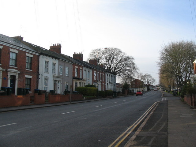
Image: © E Gammie Taken: 20 Dec 2013
The fenced area beyond the large copper beech on the left was previously a petrol station, demolished some years ago and still undeveloped. The buildings on the left are at the northern edge of the 19th century Chapelfields bounded by Craven Street, Mount Street and Allesley Old Road which housed watchmakers' premises. The current Chapelfields encompasses a larger area. Allesley Old Road itself once formed part of an old coach road between London and Holyhead when it was the turnpike road to Birmingham, before being bypassed by the construction of Holyhead Road as part of Telford's 1830s improvements to the route. A tram route ran along the road as far as Mount Street between 1905 and 1932, by which time it fell well short of serving the extended area of housing constructed further along the road during the 1920s and was replaced by a bus service. In 1981: Image]
Images are licensed for reuse under creativecommons.org/licenses/by-sa/2.0
Image Location
Latitude
52.408085
Longitude
-1.533519