Rear of houses in Buckeridge Road from West Buckeridge
Introduction
The photograph on this page of Rear of houses in Buckeridge Road from West Buckeridge by Robin Stott as part of the Geograph project.
The Geograph project started in 2005 with the aim of publishing, organising and preserving representative images for every square kilometre of Great Britain, Ireland and the Isle of Man.

There are currently over 7.5m images from over 14,400 individuals and you can help contribute to the project by visiting https://www.geograph.org.uk
Rear of houses in Buckeridge Road from West Buckeridge
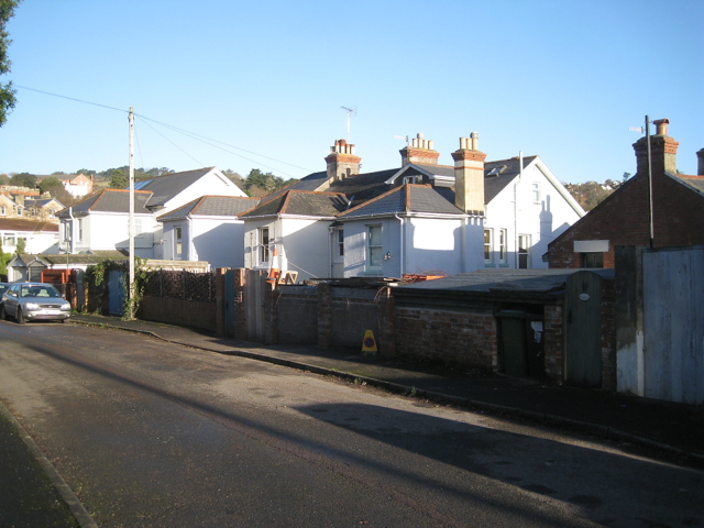
Image: © Robin Stott Taken: 10 Dec 2012
Teignmouth's suburbs are on a generally south-facing steep hillside (or valley side). It is common for rear access to houses to be at first floor level, as here. West Buckeridge follows the contours: perhaps it was laid out in the days of horse-drawn traffic. Its modern neighbour, The Mount, charges up the steep hillside. Would Teignmouth's suburbs have spread as far as they have without the car and the bus?
Images are licensed for reuse under creativecommons.org/licenses/by-sa/2.0
Image Location
Latitude
50.552772
Longitude
-3.498906