Looking along Burgate
Introduction
The photograph on this page of Looking along Burgate by Marathon as part of the Geograph project.
The Geograph project started in 2005 with the aim of publishing, organising and preserving representative images for every square kilometre of Great Britain, Ireland and the Isle of Man.

There are currently over 7.5m images from over 14,400 individuals and you can help contribute to the project by visiting https://www.geograph.org.uk
Looking along Burgate
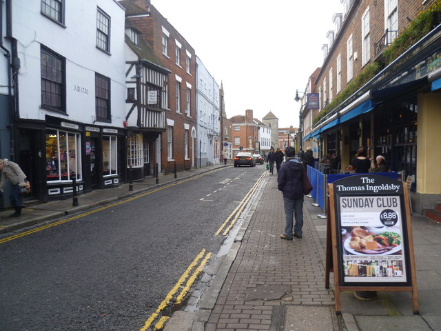
Image: © Marathon Taken: 14 Dec 2013
This view looks along Burgate from by the city wall. It is a mixture of dates with most of the buildings on the right appearing to be modern while the building on the left has AD 1550 quite clearly on its wall. The half-timbered building beyond is the Moat Tea Rooms. The tower in the distance belongs to St Mary Magdalene, the church having been demolished in 1871.
Images are licensed for reuse under creativecommons.org/licenses/by-sa/2.0
Image Location
Latitude
51.278243
Longitude
1.083763