Dundonald railway station (site of) (1)
Introduction
The photograph on this page of Dundonald railway station (site of) (1) by Albert Bridge as part of the Geograph project.
The Geograph project started in 2005 with the aim of publishing, organising and preserving representative images for every square kilometre of Great Britain, Ireland and the Isle of Man.

There are currently over 7.5m images from over 14,400 individuals and you can help contribute to the project by visiting https://www.geograph.org.uk
Dundonald railway station (site of) (1)
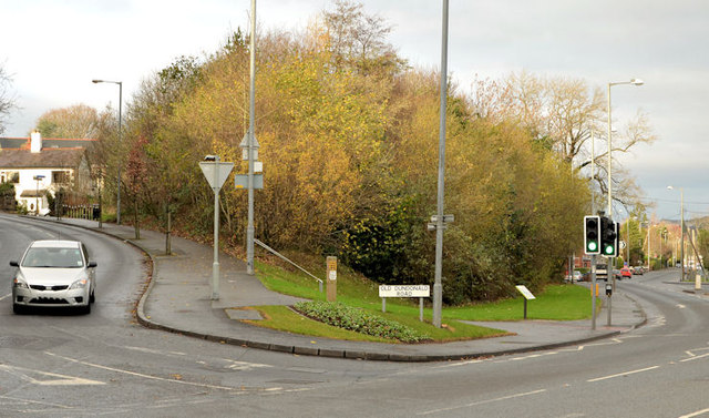
Image: © Albert Bridge Taken: 9 Dec 2013
Dundonald station was on an embankment at the apex of the Old Dundonald Road (left) and the Comber Road. The station has gone but the trackbed is now part of the Comber Greenway Image – marked by the conspicuous clump of trees. This view is towards Knock station Image and Queen’s Quay Image The Comber Road (foreground) was crossed by an underbridge. Image shows a similar view from the Greenway.
Images are licensed for reuse under creativecommons.org/licenses/by-sa/2.0
Image Location
Latitude
54.586126
Longitude
-5.79976