The view down Charlemont Road, Teignmouth
Introduction
The photograph on this page of The view down Charlemont Road, Teignmouth by Robin Stott as part of the Geograph project.
The Geograph project started in 2005 with the aim of publishing, organising and preserving representative images for every square kilometre of Great Britain, Ireland and the Isle of Man.

There are currently over 7.5m images from over 14,400 individuals and you can help contribute to the project by visiting https://www.geograph.org.uk
The view down Charlemont Road, Teignmouth
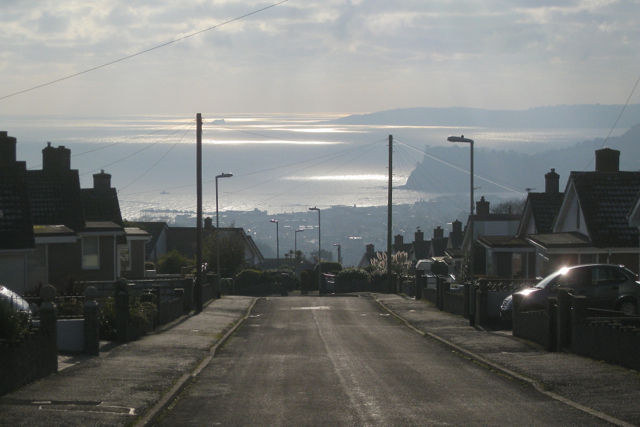
Image: © Robin Stott Taken: 11 Dec 2012
I'd taken one of the town buses for the steep mile up from the town centre to these hillside residential roads, wandered about and was stunned by the views, the reflected sun and the procession of cloud shadows over the sea. In the distance is Thatcher Rock and Hope's Nose, the northern tip of Torbay. Closer to the camera is the Ness across the River Teign, and Teignmouth pier left of centre.
Images are licensed for reuse under creativecommons.org/licenses/by-sa/2.0
Image Location
Latitude
50.561237
Longitude
-3.498045