The River Ash: view upstream from Squire's Bridge
Introduction
The photograph on this page of The River Ash: view upstream from Squire's Bridge by Stefan Czapski as part of the Geograph project.
The Geograph project started in 2005 with the aim of publishing, organising and preserving representative images for every square kilometre of Great Britain, Ireland and the Isle of Man.

There are currently over 7.5m images from over 14,400 individuals and you can help contribute to the project by visiting https://www.geograph.org.uk
The River Ash: view upstream from Squire's Bridge
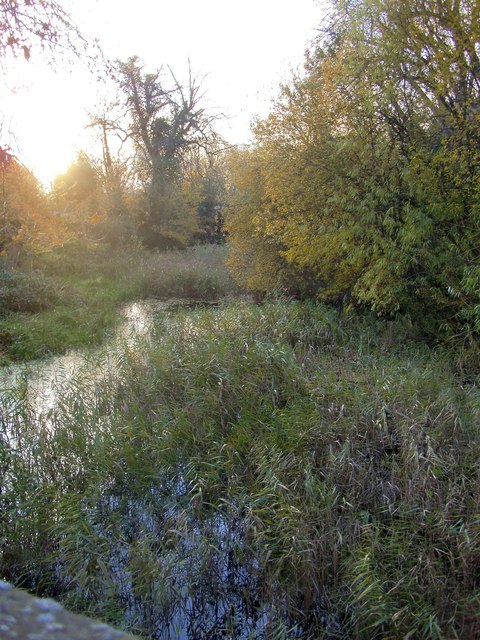
Image: © Stefan Czapski Taken: 4 Dec 2013
Unlike many rivers in south-east England, the Ash has not been engineered into a narrow stream-bed between steep banks. On the other hand, it has lost much of its natural catchment - to the vast reservoirs to the west and south of Heathrow. Walking upstream from this point I found only one spot where there was any visible flow - and that was where there was a little weir. The impression is less of a river than of a series of pools - the one seen here being well overgrown with reeds.
Images are licensed for reuse under creativecommons.org/licenses/by-sa/2.0
Image Location
Latitude
51.404736
Longitude
-0.463957