St Padarn's Church Hall
Introduction
The photograph on this page of St Padarn's Church Hall by Ian Capper as part of the Geograph project.
The Geograph project started in 2005 with the aim of publishing, organising and preserving representative images for every square kilometre of Great Britain, Ireland and the Isle of Man.

There are currently over 7.5m images from over 14,400 individuals and you can help contribute to the project by visiting https://www.geograph.org.uk
St Padarn's Church Hall
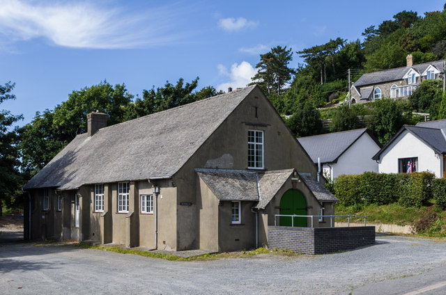
Image: © Ian Capper Taken: 31 Aug 2013
1930s church hall for St Padarn's Church in Llanbadarn Fawr. The 1888 OS map shows the building in the right background as a school, with the 1905 map showing it as a Sunday School, presumably the precursor to the present hall. By the time of the 1937 map, with the hall shown, it is unmarked, whilst maps since the 1960s show the building to be split into three, as Penyfron Cottages.
Images are licensed for reuse under creativecommons.org/licenses/by-sa/2.0
Image Location
Latitude
52.409191
Longitude
-4.061698