The War Memorial. Epping
Introduction
The photograph on this page of The War Memorial. Epping by Lynda Poulter as part of the Geograph project.
The Geograph project started in 2005 with the aim of publishing, organising and preserving representative images for every square kilometre of Great Britain, Ireland and the Isle of Man.

There are currently over 7.5m images from over 14,400 individuals and you can help contribute to the project by visiting https://www.geograph.org.uk
The War Memorial. Epping
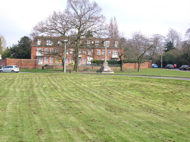
Image: © Lynda Poulter Taken: 19 Nov 2006
This is taken from the green in front of the Catholic Church of The Immaculate Conception on Church Hill. The building in the background are flats called Spriggs Oak. They were built to replace a maternity home that was bombed out during the 2nd world war, killing 7 women. The road on the right is the B1393.
Images are licensed for reuse under creativecommons.org/licenses/by-sa/2.0
Image Location
Latitude
51.70323
Longitude
0.117208