The Cholmondeley Arms
Introduction
The photograph on this page of The Cholmondeley Arms by Jeff Buck as part of the Geograph project.
The Geograph project started in 2005 with the aim of publishing, organising and preserving representative images for every square kilometre of Great Britain, Ireland and the Isle of Man.

There are currently over 7.5m images from over 14,400 individuals and you can help contribute to the project by visiting https://www.geograph.org.uk
The Cholmondeley Arms
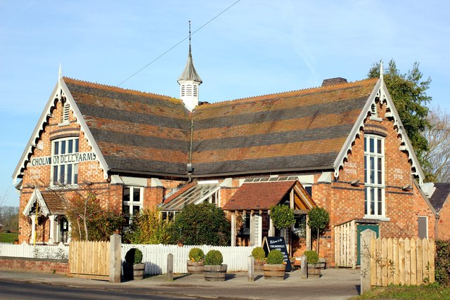
Image: © Jeff Buck Taken: 30 Nov 2013
The Cholmondeley Arms is a former Victorian village schoolhouse on Lord Cholmondeley’s estate. The old schoolhouse was built in 1862 and was converted to a pub in 1988. Cholmondeley Arms http://cholmondeleyarms.co.uk/wordpress/
Images are licensed for reuse under creativecommons.org/licenses/by-sa/2.0
Image Location


Leaflet Map data © OpenStreetMap
Latitude
53.049788
Longitude
-2.668717